


FAIRVIEW TWP Voting District, Allamakee County, Iowa
About
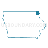
Outline

Summary
| Unique Area Identifier | 581367 |
| Name | FAIRVIEW TWP Voting District |
| County | Allamakee County |
| State | Iowa |
| Area (square miles) | 25.57 |
| Land Area (square miles) | 24.29 |
| Water Area (square miles) | 1.28 |
| % of Land Area | 94.98 |
| % of Water Area | 5.02 |
| Latitude of the Internal Point | 43.10898130 |
| Longtitude of the Internal Point | -91.21203270 |
Maps


Graphs
Select a template below for downloading or customizing gragh for FAIRVIEW TWP Voting District, Allamakee County, Iowa


Neighbors
Neighoring Voting District (by Name) Neighboring Voting District on the Map
- EASTMAN - T 1 Voting District, Crawford County, WI
- GIARD TWP Voting District, Clayton County, IA
- LINTON TWP Voting District, Allamakee County, IA
- MENDON TWP Voting District, Clayton County, IA
- PAINT CREEK TWP Voting District, Allamakee County, IA
- PRAIRIE DU CHIEN - T 1 Voting District, Crawford County, WI
- TAYLOR TWP Voting District, Allamakee County, IA
Top 10 Neighboring County Subdivision (by Population) Neighboring County Subdivision on the Map
- Mendon township, Clayton County, IA (1,888)
- Prairie du Chien town, Crawford County, WI (1,073)
- Eastman town, Crawford County, WI (739)
- Taylor township, Allamakee County, IA (662)
- Paint Creek township, Allamakee County, IA (544)
- Giard township, Clayton County, IA (376)
- Linton township, Allamakee County, IA (305)
- Fairview township, Allamakee County, IA (240)
Top 10 Neighboring Unified School District (by Population) Neighboring Unified School District on the Map
- Allamakee Community School District, IA (8,992)
- Prairie du Chien Area School District, WI (8,669)
- MFL MarMac Community School District, IA (5,385)
Top 10 Neighboring State Legislative District Lower Chamber (by Population) Neighboring State Legislative District Lower Chamber on the Map
- Assembly District 96, WI (55,740)
- State House District 16, IA (29,039)
- State House District 24, IA (28,093)
Top 10 Neighboring State Legislative District Upper Chamber (by Population) Neighboring State Legislative District Upper Chamber on the Map
- State Senate District 32, WI (172,379)
- State Senate District 8, IA (57,073)
- State Senate District 12, IA (56,900)
Top 10 Neighboring 111th Congressional District (by Population) Neighboring 111th Congressional District on the Map
- Congressional District 3, WI (729,957)
- Congressional District 4, IA (609,487)
- Congressional District 1, IA (596,443)
Top 10 Neighboring Census Tract (by Population) Neighboring Census Tract on the Map
- Census Tract 9604, Crawford County, WI (3,233)
- Census Tract 701, Clayton County, IA (3,080)
- Census Tract 9603, Crawford County, WI (2,486)
- Census Tract 9604, Allamakee County, IA (2,343)
Top 10 Neighboring 5-Digit ZIP Code Tabulation Area (by Population) Neighboring 5-Digit ZIP Code Tabulation Area on the Map
- 53821, WI (8,456)
- 52159, IA (2,330)
- 52157, IA (1,828)
- 54626, WI (1,215)
- 52146, IA (1,039)
- 52158, IA (314)